Rare original antique maps & antique charts are fascinating combinations of history, science and art. They represent not only discoveries from previous centuries, they also show the misconceptions of mapmakers. The inaccuracies and variations of coastlines and country borders have made antique maps and charts highly coveted and collectable.
Previously regarded as a male domain, collecting antique maps appeals to both sexes and all ages. Enjoyment of antique maps and charts comes from an interest in geography, astronomy, history, genealogy, nostalgia for previous times, or simply an interest in their many styles of artistic representation. Antique maps are bought for many reasons. They provide a wonderful display of the world as previously represented, and can be an intellectually stimulating and impressive wall display – particularly grand world maps from different periods. Most maps are hung in studies, offices and boardrooms, but they add distinction to any room, and are a great talking point.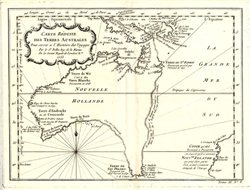
Map collectors sometimes secrete their antique maps - protected by special conservation storage materials, and peer at them through a magnifying glass – always finding additional interesting details and inaccuracies. Antique maps provide a visual narrative of early voyages of discovery and remind us of the hardships of the quests for new lands that were so arduously undertaken hundreds of years ago... without the convenience and technology of modern craft and instruments.
Navigation and charting of a newly discovered coastline was not necessarily as inaccurate as the artistic creation of the mapmaker. On his map of Australia, circa 1753 (nearly 20 years before Cook’s charting of the east coast) Jacques Nicolas Bellin showed a rough dotted line up the east coast of Australia, and actually printed along the line (in French) “I suppose that Van Diemen’s Land (Tasmania) could join to Terre du St Esprit (Vanuatu).. but without proof” and continued such a line to join up with Papua New Guinea! This is probably the most coveted antique map of early Australia.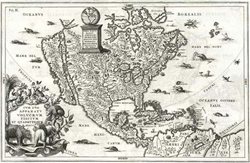
Different mapmakers used different styles of presentation of the information that was available to them. Early paper was hand-made and engraving styles varied considerably – as did the embellishment of the maps. Important editions of antique maps were often decorated by one or more cartouche that enclosed the title and identified the cartographer or mapmaker, and sometimes the date of publication. Early cartouches were frequently of allegorical subjects, as in the map circa 1702 by Jesuit priest Heinrich Scherer who combined religious images with sublime images of cherubs or putti, and went on to include images of strange animals, sea creatures, and birds – which were often also geographically accurate. His spectacular maps have strongly engraved geographic detail and images, but are perhaps more popular for their inaccuracies. Scherer's map circa 1702 with California as an island is particularly noteworthy.
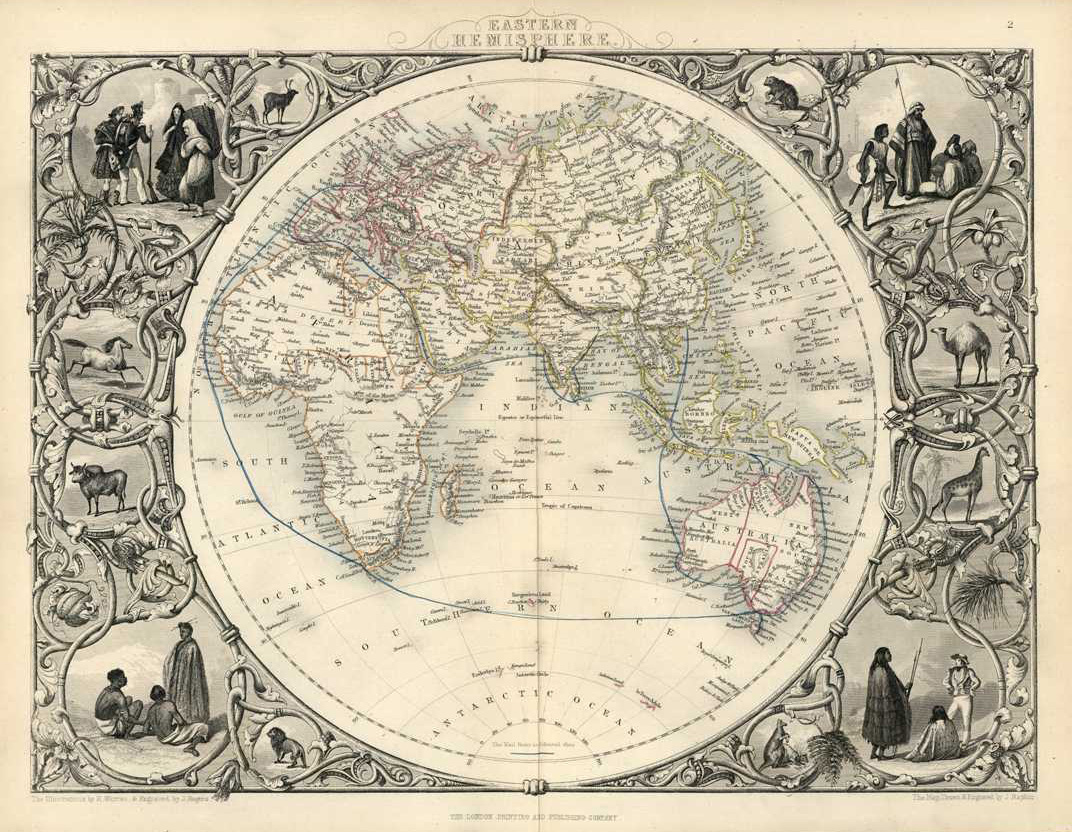
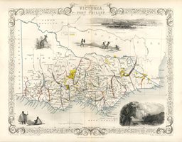 In the middle of the 19th century maps were engraved on steel plates. The more decorative ones were decorated by engraved borders. John Tallis and Company maps circa 1850-1856 were renowned for their finely engraved maps by John Rapkin. As well as elegantly engraved borders of twining foliage and cartouche title pieces with scrolls, important scenes of towns, objects, people and fauna of the region are engraved in the vignettes that surround Tallis maps. Tallis maps of Eastern Hemisphere and Western Hemisphere were two of the most heavily embellished maps of all. Tallis was one of the last companies to publish decorative maps of countries, as the specialist skill and the time taken for the illustrations proved too expensive. Tallis maps of the Australian states are the most decorative ever done on Australia. Some editions even showed gold regions of the period (as above).
Styles of antique maps vary as much as their content. Prices reflect popularity as well as individual importance, rarity and condition. No matter how little or how much you pay, the subject matter can continue to fascinate as the years go by. There are maps of all regions, representing ancient times as well as contemporary to the date of publication. The challenge is in finding the map that ‘tickles your fancy’.
If you are intere
sted in a particular region or date, let us
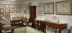
assist in your search: sales@antiqueprintclub.com. If you would like a pleasant day in the country - only one hour down the motorway from Brisbane, email us or phone 0412 442 283 to arrange a mutually suitable time to visit the Antique Print Clubhouse at Neranwood in the hills behind the Gold Coast west of Mudgeeraba. We have hundreds of rare, original antique maps and charts from c1600 to c1800.